Respiratory physician Lutz Beckert considers chronic obstructive pulmonary disease management, including the prevention of COPD, the importance of smoking cessation and pulmonary rehabilitation, and the lifesaving potential of addressing treatable traits. He also discusses the logic of inhaler therapy, moving from single therapy to dual and triple therapy when indicated, as well as other aspects of management
On top of the world at Te Tai Poutini
On top of the world at Te Tai Poutini

Retired GP Jim Vause gets a chance to traverse one of the Great Walks on the West Coast, and gratefully shares the pictures
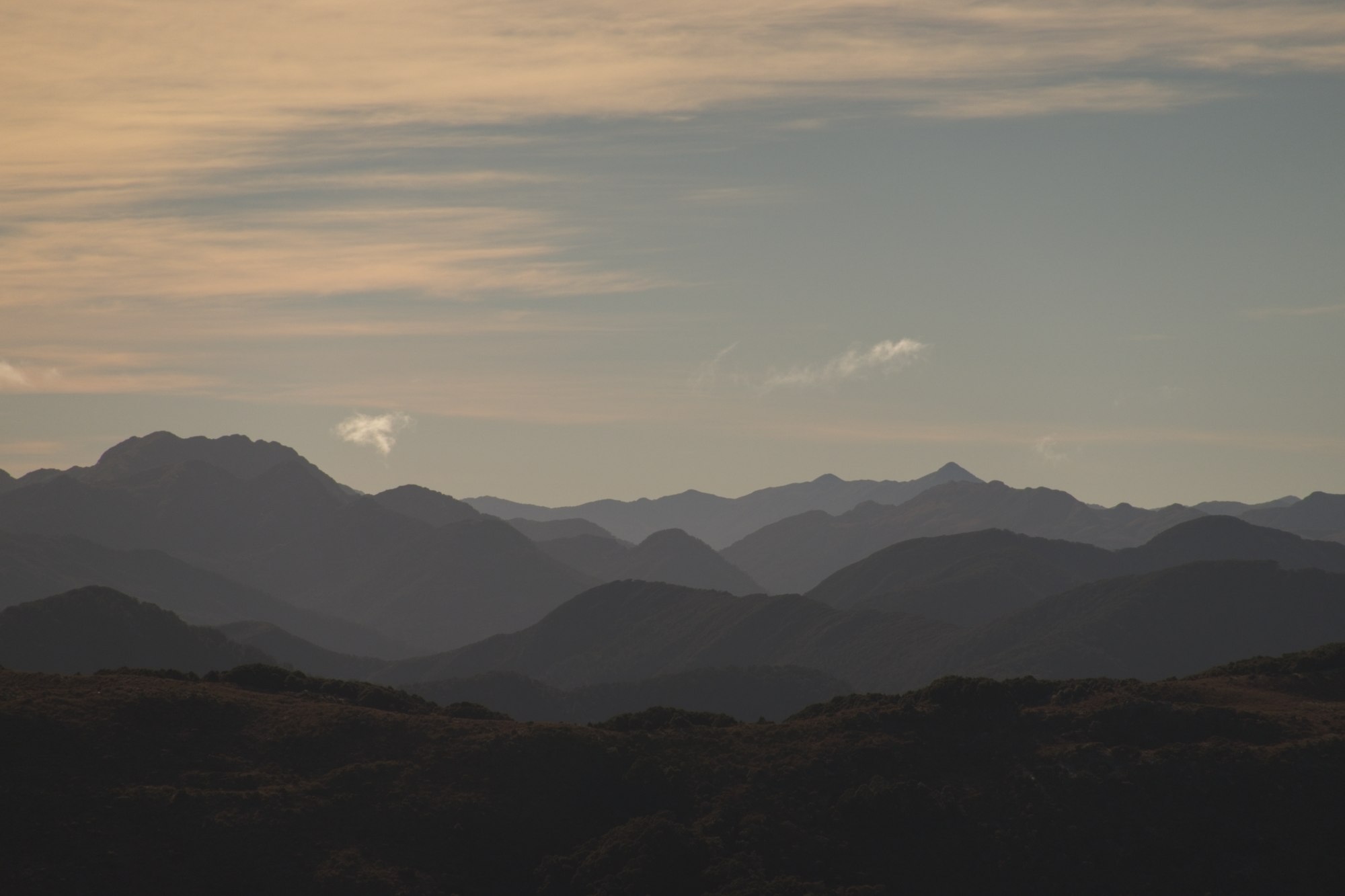
It may have been red sky at dawn but, not being shepherds, the portent of a stunning day awoke us early. The previous day’s climb from Blackball to Ces Clark Hut had been through native bush, but now, 1000m above the mist-covered valley floor, the open tops of the Paparoa Ridge were bathed in a bright morning sun and one could see for miles and miles and miles. The roof top of Te Tai Poutini.
We had lucked upon a booking for the Paparoa Track for, like most Great Walks, huts are booked out many months in advance. But thanks to editor Barbara Fountain’s preoccupation with the New Zealand Primary Healthcare Awards He Tohu Mauri Ora, we had been presented with an opportunity not to be missed.
For those unfamiliar with the Buller region, the Paparoas are the coastal range that lies between the Buller and Grey Rivers.
Thrust from the Tasman many millennia ago, their short history in human times has seen witness to such events as the final battle of the greenstone wars between Ngāti Wairangi and Ngāi Tahu in the early 1800s, the birthplace of the Labour movement at Blackball in 1908, the Cave Creek disaster in 1995 and, of course, the recent Pike River Mine tragedy.
In fact, the mine itself lies underground barely a kilometre east of the track itself, a tribute to the ranges’ appeal to humanity’s insatiable lust for both black and yellow gold.
Blackball, with its own fascinating history and some pretty reasonable real estate prices, is a town formed by coal and the starting point for the Paparoa Track.
The original Croesus Track forms the first day’s hike, ascending 1000m over the range before dropping towards the Tasman coast at Barrytown. Rugby teams from Blackball would run across the track on Saturday morning to play in Barrytown and run back after the match- the next day, one would suspect.
Our first night was at Ces Clark Hut, sited above the bush line with the panorama of the Grey Valley laid out far below. From here, the track splits from Croesus, staying on the tops heading north, dancing and diving around the various summits and saddles that form the Paparoa Ridge.
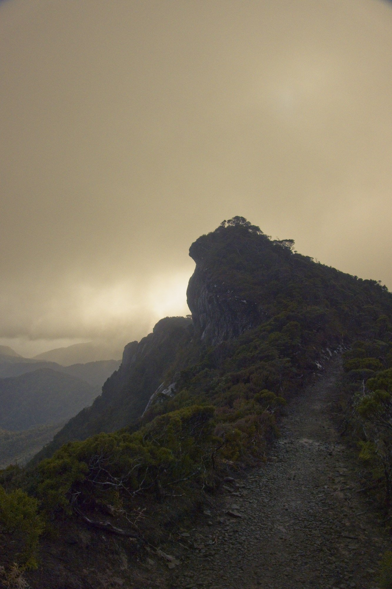
This short, second day’s hike ends with the stunning vista of the Pike Stream Escarpment, revealing like a travel movie as you round the final corner before the Moonlight Tops Hut. To the west, the Tasman, to the east, the Alps, and if it isn’t raining, it soon will be.
This hut is also the overnight stop for the many cyclists, so is invariably full, except for the odd cancellation, resultant of an adverse weather forecast.
Within an hour of our arrival a cool easterly cap cloud formed over the escarpment, offering a great time lapse photo opportunity, before a front hammered wind, hail and thunder into the hut overnight. Thus, the next morning we set off somewhat intimidated by the prospect of traversing 10km of a very exposed Pike Stream Escarpment.
Fortunately, conditions slowly improved, the rain lightened and the mist cleared. Patches of stunted vegetation heralded the coal-rich headwaters of the Pike River Valley, before the track suddenly plunged down the escarpment wall, zigzagging across the face with engorged waterfalls plummeting spectacularly down the sheer rock.
This is where the track engineers earned their bikkies, their drill marks evidence of the explosive might used to blast the track from the metamorphic rock of the range.
It was all downhill from here, but for a final stiff climb up to Pororari Hut cunningly designed by the track constructors to test our weary limbs. This hut, like the others, was of a Great Walk standard and only a jacuzzi and bar would be needed to attract tourists, which of course we were not.
The final day was a short 17km jaunt through the three gorges of the Pororari River in a varied landscape of punga forests, podacarps and areas regenerating, not from human devastation, but from Mother Nature, wind damage by cyclones Gita and Fehi.
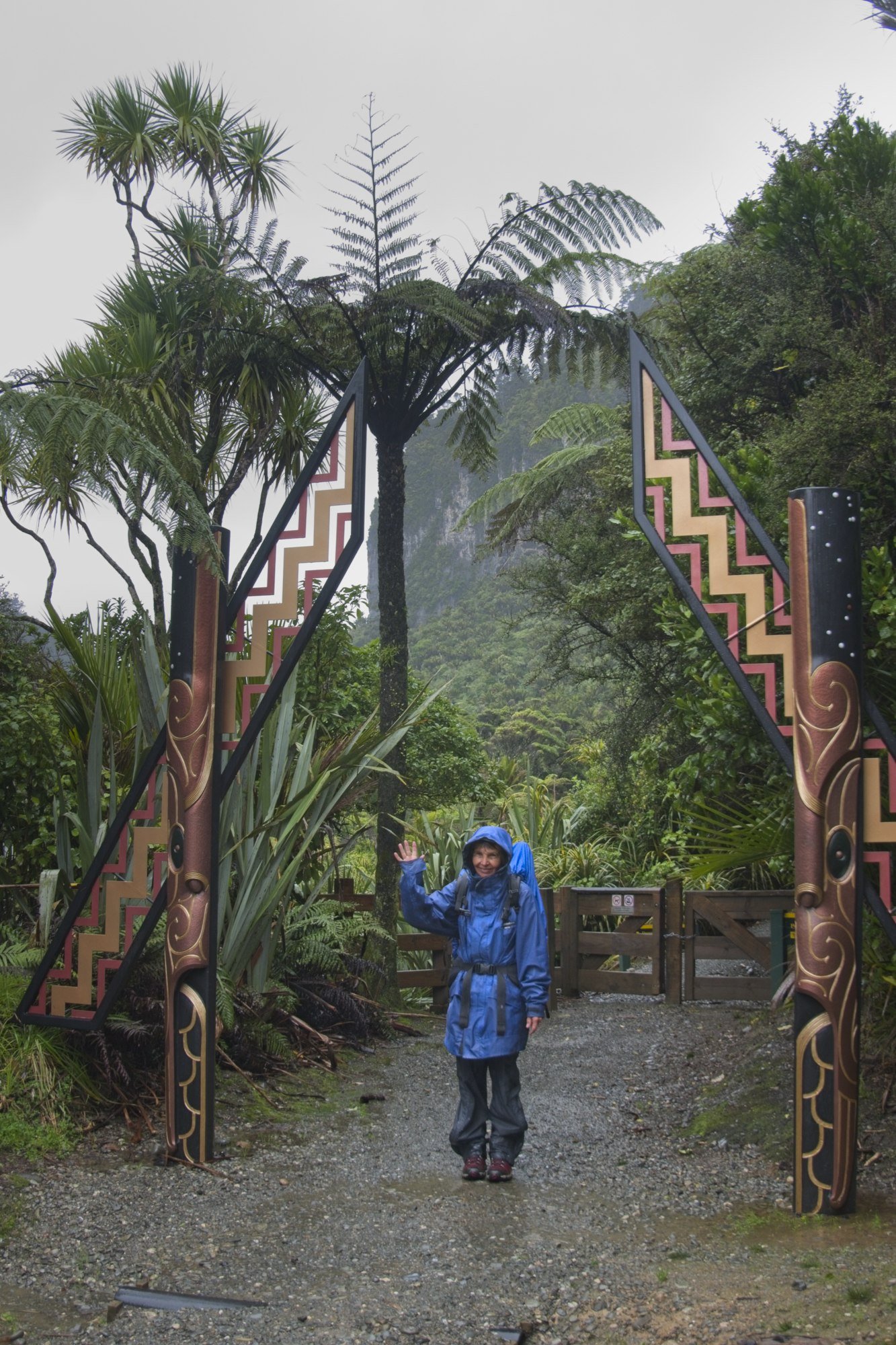
Alas, she also brought incessant precipitation that worsened, so by the time we emerged at Punakaiki my brand-new, poncy 10,000-proof rain jacket was soaked through. Should have brought an umbrella.
Would I do it again? Yes, but by bike. It would be challenging on the uphill parts, especially with an umbrella, due to the very rocky nature of the Croesus Track section, but those downhills would make it worthwhile. If the guns can manage the track’s 56km in five and half hours, two days should be achievable for me. Plus I wouldn’t need diclofenac for my cartilagenously challenged knees. Just got to get the weather right.
- Log in to post comments


![Barbara Fountain, editor of New Zealand Doctor Rata Aotearoa, and Paul Hutchison, GP and senior medical clinician at Tāmaki Health [Image: Simon Maude]](/sites/default/files/styles/thumbnail_cropped_100/public/2025-03/Barbara%20Fountain%2C%20editor%20of%20New%20Zealand%20Doctor%20Rata%20Aotearoa%2C%20and%20Paul%20Hutchison%2C%20GP%20and%20senior%20medical%20clinician%20at%20T%C4%81maki%20Health%20CR%20Simon%20Maude.jpg?itok=-HbQ1EYA)
![Lori Peters, NP and advanced health improvement practitioner at Mahitahi Hauora, and Jasper Nacilla, NP at The Terrace Medical Centre in Wellington [Image: Simon Maude]](/sites/default/files/styles/thumbnail_cropped_100/public/2025-03/2.%20Lori%20Peters%2C%20NP%20and%20advanced%20HIP%20at%20Mahitahi%20Hauora%2C%20and%20Jasper%20Nacilla%2C%20NP%20at%20The%20Terrace%20Medical%20Centre%20in%20Wellington%20CR%20Simon%20Maude.jpg?itok=sUfbsSF1)
![Ministry of Social Development health and disability coordinator Liz Williams, regional health advisors Mary Mojel and Larah Takarangi, and health and disability coordinators Rebecca Staunton and Myint Than Htut [Image: Simon Maude]](/sites/default/files/styles/thumbnail_cropped_100/public/2025-03/3.%20Ministry%20of%20Social%20Development%27s%20Liz%20Williams%2C%20Mary%20Mojel%2C%20Larah%20Takarangi%2C%20Rebecca%20Staunton%20and%20Myint%20Than%20Htut%20CR%20Simon%20Maude.jpg?itok=9ceOujzC)
![Locum GP Helen Fisher, with Te Kuiti Medical Centre NP Bridget Woodney [Image: Simon Maude]](/sites/default/files/styles/thumbnail_cropped_100/public/2025-03/4.%20Locum%20GP%20Helen%20Fisher%2C%20with%20Te%20Kuiti%20Medical%20Centre%20NP%20Bridget%20Woodney%20CR%20Simon%20Maude.jpg?itok=TJeODetm)
![Ruby Faulkner, GPEP2, with David Small, GPEP3 from The Doctors Greenmeadows in Napier [Image: Simon Maude]](/sites/default/files/styles/thumbnail_cropped_100/public/2025-03/5.%20Ruby%20Faulkner%2C%20GPEP2%2C%20with%20David%20Small%2C%20GPEP3%20from%20The%20Doctors%20Greenmeadows%20in%20Napier%20CR%20Simon%20Maude.jpg?itok=B0u4wsIs)
![Rochelle Langton and Libby Thomas, marketing advisors at the Medical Protection Society [Image: Simon Maude]](/sites/default/files/styles/thumbnail_cropped_100/public/2025-03/6.%20Rochelle%20Langton%20and%20Libby%20Thomas%2C%20marketing%20advisors%20at%20the%20Medical%20Protection%20Society%20CR%20Simon%20Maude.jpg?itok=r52_Cf74)
![Specialist GP Lucy Gibberd, medical advisor at MPS, and Zara Bolam, urgent-care specialist at The Nest Health Centre in Inglewood [Image: Simon Maude]](/sites/default/files/styles/thumbnail_cropped_100/public/2025-03/7.%20Specialist%20GP%20Lucy%20Gibberd%2C%20medical%20advisor%20at%20MPS%2C%20and%20Zara%20Bolam%2C%20urgent-care%20specialist%20at%20The%20Nest%20Health%20Centre%20in%20Inglewood%20CR%20Simon%20Maude.jpg?itok=z8eVoBU3)
![Olivia Blackmore and Trudee Sharp, NPs at Gore Health Centre, and Gaylene Hastie, NP at Queenstown Medical Centre [Image: Simon Maude]](/sites/default/files/styles/thumbnail_cropped_100/public/2025-03/8.%20Olivia%20Blackmore%20and%20Trudee%20Sharp%2C%20NPs%20at%20Gore%20Health%20Centre%2C%20and%20Gaylene%20Hastie%2C%20NP%20at%20Queenstown%20Medical%20Centre%20CR%20Simon%20Maude.jpg?itok=Z6u9d0XH)
![Mary Toloa, specialist GP at Porirua and Union Community Health Service in Wellington, Mara Coler, clinical pharmacist at Tū Ora Compass Health, and Bhavna Mistry, specialist GP at Porirua and Union Community Health Service [Image: Simon Maude]](/sites/default/files/styles/thumbnail_cropped_100/public/2025-03/9.%20Mary%20Toloa%2C%20Porirua%20and%20Union%20Community%20Health%20Service%20in%20Wellington%2C%20Mara%20Coler%2C%20T%C5%AB%20Ora%20Compass%20Health%2C%20and%20Bhavna%20Mistry%2C%20PUCHS%20CR%20Simon%20Maude.jpg?itok=kpChr0cc)